The first step in the S.U.E. Process
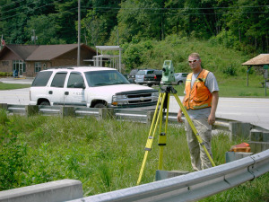
 Allied Associates, P.A. (Allied) specializes in marking and mapping of subsurface utilities. The surveying and mapping service offered by Allied incorporates surface marking/painting of underground non-gravity utilities with remote sensing devices. Records provided by utility owners aid with location and identification. Survey teams, utilizing conventional or GPS survey methods locate the designation markings and above ground utility components with respect to project control. Survey data is integrated into client’s project mapping allowing Engineers the option of avoidance or evaluating relocation.
SUE Surveying Service requests are categorized by the Federal Highway Administration into four Quality Levels. Engineers requesting this service will define the Quality Level that best suits their project needs. Often times the request advances to Level A as a result of data made available in the lower levels. Allied has the resources to provide all levels of surveying service as detailed below:
SUE Quality Level D (QL-D)
The least precise level of SUE Surveying Services, QL-D is mostly used by Engineers for developing feasibility studies and projects evaluation. QL-D mapping is compiled based on existing utility owner records and are usually completed without a site visit.
 SUE Quality Level C (QL-C)
Perhaps the most commonly-requested level of SUE Surveying Services, QL-C is based on horizontal location of above-ground utility components. Typically, manhole covers, valve boxes, pedestals, and pole drops are field surveyed and coupled with record drawings to compile mapping. QL-C drawings are a useful and cost-effective tool aiding engineers in decision making during the project planning stage.
SUE Quality Level B (QL-B)
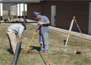
Generally requested by engineers during the early design phases of construction projects. QL-B requires a field team to locate and mark, by paint or flags, underground components using remote sensing equipment. Field survey teams, under the direct supervision of a Professional Land Surveyor, collect the horizontal location of these markings and prepare data for integrating into client project mapping. This delivers value to engineers, enabling project designs to factor in existing utility locations. Having this data available during design reduces the need to mitigate utility conflicts during construction.
SUE Quality Level A (QL-A)

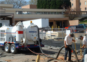
QL-A requires obtaining a precise horizontal and vertical location of underground utilities. Engineers requesting QL-A specifies the general location of the utility posing design conflict, along with the size, type, and material of the utility. The exact location of the utility is obtained by exposing a small section, test hole, of the utility. At Allied, this is accomplished using non-destructive vacuum excavation equipment. The exposed utility is field located by a team of expert survey technicians, under the direct supervision of a Professional Land Surveyor. The data is reported using a “Test Hole Report” or mapping. The report or mapping details utility information provide to us by the requesting engineer and the horizontal and vertical data collected by our survey team. If the project is defined by an alignment, we provide the station and offset of the actual point located on the utility. QL-A as defined by the Federal Highway Administration includes an engineering element of evaluating the condition, material and other characteristics of the underground feature. Allied does not offer the engineering services that fall within QL-A.
NOTE: Allied Associates, P.A. does not offer Engineering Services, solely Profession Land Surveying
Allied Associates, P.A. is a highly-skilled provider of land surveying and subsurface utility location & survey to state, municipal, commercial, industrial, and residential clients throughout North Carolina since 2001.

